Join us to explore the creation of a UNESCO Global Geopark for Georgian Bay and the North Channel.
Around the world, UNESCO Global Geoparks celebrate some of the planet’s most extraordinary places—landscapes where geology, nature, culture, and communities come together to tell stories that connect the past with the future. There are 241 Global Geoparks in 51 countries.
Could Georgian Bay and the North Channel become one of them?
All involved believe that the UNESCO Global Geopark model and framework based on the entire region’s internationally significant geological heritage is the best way to have its distinctiveness and qualities advanced through protection, education, and sustainable economic development.
The Georgian Bay Geopark Initiative is a grassroots, community-led effort exploring how this internationally recognized model could help celebrate, understand, and safeguard one of Canada’s most remarkable regions.
This website shares the foundation we have begun to build through research, partnerships, and listening. It is not a completed plan—it is the starting point for an open conversation.
We invite everyone with a connection to Georgian Bay and the North Channel to explore, contribute, and help shape what comes next.
After three years of foundational research, partnership building, and listening, we are entering a new phase — sharing what we’ve learned and inviting communities, municipalities, and First Nations across the region into an open and transparent dialogue. Together, let us imagine what can be created for the lands, the waters, the cultures, and the generations yet to come in this extraordinary part of Canada.
Explore the Geological Past. Create a Sustainable Future
Geological events naturally divide the region into eight DEEP TIME Zones. This can help us all gain a better understanding and appreciation of history and the future of the entire watershed. Geology helps tell us how all of those who inhabit the lands have made their mark and how we can all work to shape the coming years.
Discover the DEEP TIME geology of the Georgian Bay Geopark
DEEP TIME’ is the themed expression of how exploring and understanding the past helps create a better future. The unique DEEP TIME story and its eight geological chapters encourages both visitors and residents to know the past, celebrate the present and help create a more resilient future for the Bay and its many communities.
DEEP TIME Zone 1
2.7 billion years Sault Ste Marie to Serpent River
The ancient mineral-rich rocks of the North Channel record the breakup of the planet’s oldest supercontinent – and the birth of the Huronian Ocean.
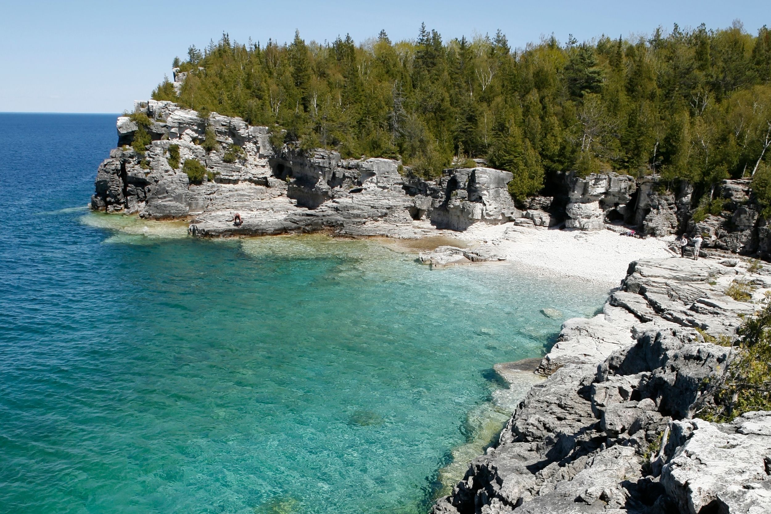
Within the last 2 million years, the Bruce/Saugeen peninsula was scoured by Ice Age ice sheets that cut deep valleys into the face of the Niagara Escarpment such as at Owen Sound.
The raised beaches of glacial Lake Algonquin surround the coast of southern Georgian Bay like staircases and hosted the camps of caribou-hunting Paleo-Indians 11,000 years ago.
The ancient hard rocks of the Canadian Shield meet the softer limestones of the ancient seas creating a stark contrast in landscapes, ecosystems, and a diverse cultural history unique in North America.
In 1615 Samuel de Champlain called Georgian Bay ‘La Mer Douce’ (the sweet water sea). An early map also portrays it as Karegnondi, derived from ‘lake’ in the language of the Petun First Nation.