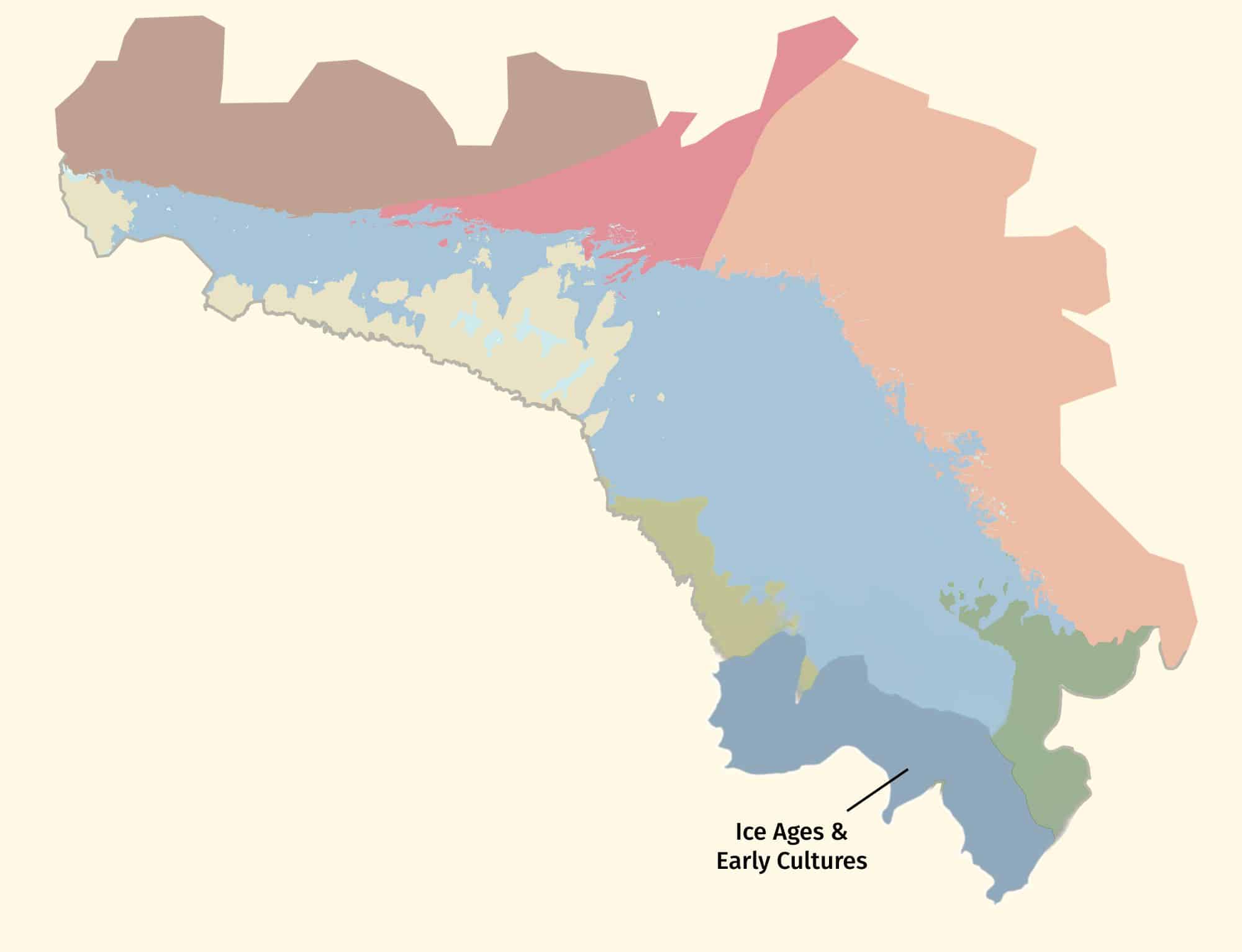
Here the Niagara Escarpment at Blue Mountain overlooks southern Georgian Bay. As the last ice sheet retreated northwards 15,000 years ago the area was flooded by the deep iceberg-infested waters of glacial Lake Algonquin. Its raised beaches surround the coast of southern Georgian Bay like staircases, such as at Midland and Penetanguishene, and hosted the camps of caribou-hunting Paleo-Indians 11,000 years ago.
You are here
Indigenous place-based narratives for DEEP TIME ZONE 6 are being developed in concert with Indigenous-owned creative agency Design de Plume, regional Knowledge Keepers and Georgian Bay Indigenous community representatives. To find out more or provide input please contact us.
Blue Mountain is the local name used for the Niagara Escarpment where it overlooks Georgian Bay. The steep face of the Escarpment is created by the presence of strong resistant rocks that are much harder than those underneath, which form the low lying areas below (and much of the floor of Georgian Bay to the north). The soft rocks are of late Ordovician age (about 450 million years old) and dominated by shale which can be seen on the Georgian Bay coast nearby at Craigleith. The Escarpment rocks are dolostones (altered limestones) and are of Silurian age (440 to about 428 million). So next time you ski at Blue Mountain think about how when you're going downhill, you're also going backwards in time to an age when Ontario was covered by shallow warm seas.
Whale oil became prohibitively expensive in the mid-nineteenth century as demand outstripped supply. Subsequently, oil shale began to be used as a cheaper alternative for lighting and lubrication. This "rock oil" industry ultimately met with limited economic success but the 450 million year old Collingwood Shale has an important place in the early history of Ontario's oil industry.
The Scenic Caves at Collingwood are excellent examples of fissure caves. These occur in the narrow gaps that form between large blocks of rock as they move downslope. Fissure caves are also called "tectonic caves" because their formation depends on the presence of joints or deep cracks in the cap rock of the Niagara Escarpment. These are the product of stresses created by the slow drift of the North American plate westward over Earth's mantle .
Located on the southwest margin of Georgian Bay, Owen Sound is the largest community on the Bay and nestled within the narrow steep-sided valley of the Sydenham River that was carved by ice-age glaciers into the face of the Niagara Escarpment, and which continues offshore under the waters of Lake Huron. At one time, when the number of its churches rivalled that of its pubs its busy waterfront once enjoyed a reputation as ‘Chicago of the North’ benefitting from the arrival of the railway in Collingwood in 1855 and the beginning of the busy steamship route to Chicago. From 1950 to 1963 the SS Norgoma connected Owen Sound with Sault Ste Marie via Killarney, the North Channel and Manitoulin Island in the absence of any improved road that connected western and eastern Ontario until as late as 1960 with final upgrading and completion of Highway 17. Since then the demise of the fishing industry and the prominence of trucking devastated maritime trade. Owen Sound is now the regional hub of Grey County and is strategically located at the base of the Bruce Peninsula and the highway to Tobermory and the car ferry to Manitoulin which still provides a westernmost road route from southern to northern Ontario.
For learning, curriculum, and digital storytelling to be guided by community input.


DEEP TIME’ is the themed expression of how exploring and understanding the past helps create a better future. The unique DEEP TIME story and its eight geological chapters encourages both visitors and residents to know the past, celebrate the present and help create a more resilient future for the Bay and its many communities.
2.7 billion years
Sault Ste Marie to Serpent River
The ancient mineral-rich rocks of the North Channel record the breakup of the planet’s oldest supercontinent – and the birth of the Huronian Ocean.
1.8 billion years
Serpent River to Killarney
The Group of Seven’s white rolling quartzite hills are the stumps of mountains formed when landmasses collided to form supercontinent Nuna
1.3 billion years
Killarney to Honey Harbour
The waterscape of the 30,000 Islands exposes the deep crustal roots of the immense Grenville Mountains formed when North and South America collided.
500 million years
Manitoulin Island
Much of North America was covered by warm shallow seas, teeming with early marine life that left fossil-rich limestones on Manitoulin Island.
350 million years
Tobermory to Wiarton
Within the last 2 million years, the Bruce/Saugeen peninsula was scoured by Ice Age ice sheets that cut deep valleys into the face of the Niagara Escarpment such as at Owen Sound.
13,000 years
Collingwood to Wiarton
13,000 years
Collingwood to Wiarton
Last 10,000 years
Collingwood to Honey Harbour
The ancient hard rocks of the Canadian Shield meet the softer limestones of the ancient seas creating a stark contrast in landscapes, ecosystems, and a diverse cultural history unique in North America.
4,000 years to today
Waters of Georgian Bay
In 1615 Samuel de Champlain called Georgian Bay ‘La Mer Douce’ (the sweet water sea). An early map also portrays it as Karegnondi, derived from ‘lake’ in the language of the Petun First Nation.