The ancient mineral-rich rocks of the North Channel record the breakup of Kenorland – the planet’s oldest supercontinent – and the birth of the Huronian Ocean 2.7 billion years ago. These rocks record key phases in the evolution of our planet’s early atmospheres and climates. Geology investigations started in the early nineteenth century with the discovery of copper at Bruce Mines.
You are here
Indigenous place-based narratives for DEEP TIME ZONE 1 are being developed in concert with Indigenous-owned creative agency Design de Plume, regional Knowledge Keepers and Georgian Bay Indigenous community representatives. To find out more or provide input please contact us.
This 100 kilometre long strip-like park bounded on its northern margin by Highway 17 protects the northern shore of Lake Huron, the so-called North Channel just east of where Huron and Lake Superior come together at Sault Ste. Marie. Here, the Canadian Shield meets the lake and is bordered by numerous rocky islands similar to the more well-known 30,000 Island area on Georgian Bay (Site C6). Old rocks meet even older rocks as the park straddles the boundary of archean igneous and metamorphic rocks (some as old as 2.7 billion years) of the Abitibi Greenstone Belt with 2.4 billion year old sedimentary rocks of the Huronian Supergroup. The islands protect its waters for boaters and provide habitat for a rich recreational fishery.
On the Bruce Mines Trail, one can view the historical legacy of mining activity. The main trail follows a railway spur and is lined with copper tailings. Topsoil has been removed to bare the rock surface. Many examples of different copper and sulphide minerals are strewn on the ground. The actual open-pit mines themselves are elongate gashes which have largely been fenced off.
For learning, curriculum, and digital storytelling to be guided by community input.


DEEP TIME’ is the themed expression of how exploring and understanding the past helps create a better future. The unique DEEP TIME story and its eight geological chapters encourages both visitors and residents to know the past, celebrate the present and help create a more resilient future for the Bay and its many communities.
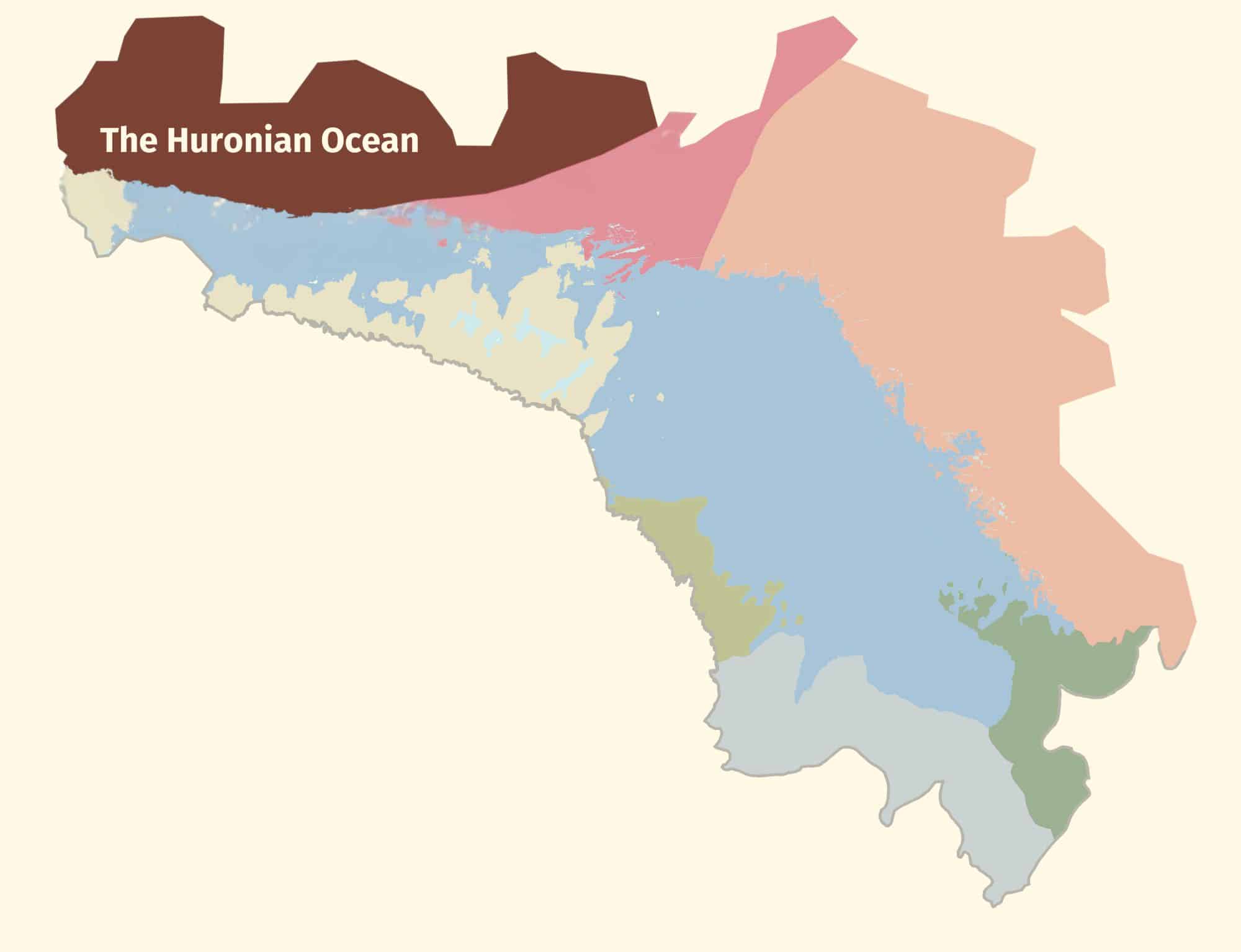
2.7 billion years
Sault Ste Marie to Serpent River
2.7 billion years
Sault Ste Marie to Serpent River
1.8 billion years
Serpent River to Killarney
The Group of Seven’s white rolling quartzite hills are the stumps of mountains formed when landmasses collided to form supercontinent Nuna
1.3 billion years
Killarney to Honey Harbour
The waterscape of the 30,000 Islands exposes the deep crustal roots of the immense Grenville Mountains formed when North and South America collided.
500 million years
Manitoulin Island
Much of North America was covered by warm shallow seas, teeming with early marine life that left fossil-rich limestones on Manitoulin Island.
350 million years
Tobermory to Wiarton
Within the last 2 million years, the Bruce/Saugeen peninsula was scoured by Ice Age ice sheets that cut deep valleys into the face of the Niagara Escarpment such as at Owen Sound.
13,000 years
Collingwood to Wiarton
The raised beaches of glacial Lake Algonquin surround the coast of southern Georgian Bay like staircases and hosted the camps of caribou-hunting Paleo-Indians 11,000 years ago.
Last 10,000 years
Collingwood to Honey Harbour
The ancient hard rocks of the Canadian Shield meet the softer limestones of the ancient seas creating a stark contrast in landscapes, ecosystems, and a diverse cultural history unique in North America.
4,000 years to today
Waters of Georgian Bay
In 1615 Samuel de Champlain called Georgian Bay ‘La Mer Douce’ (the sweet water sea). An early map also portrays it as Karegnondi, derived from ‘lake’ in the language of the Petun First Nation.